roby
February 9, 2023, 2:17pm
1
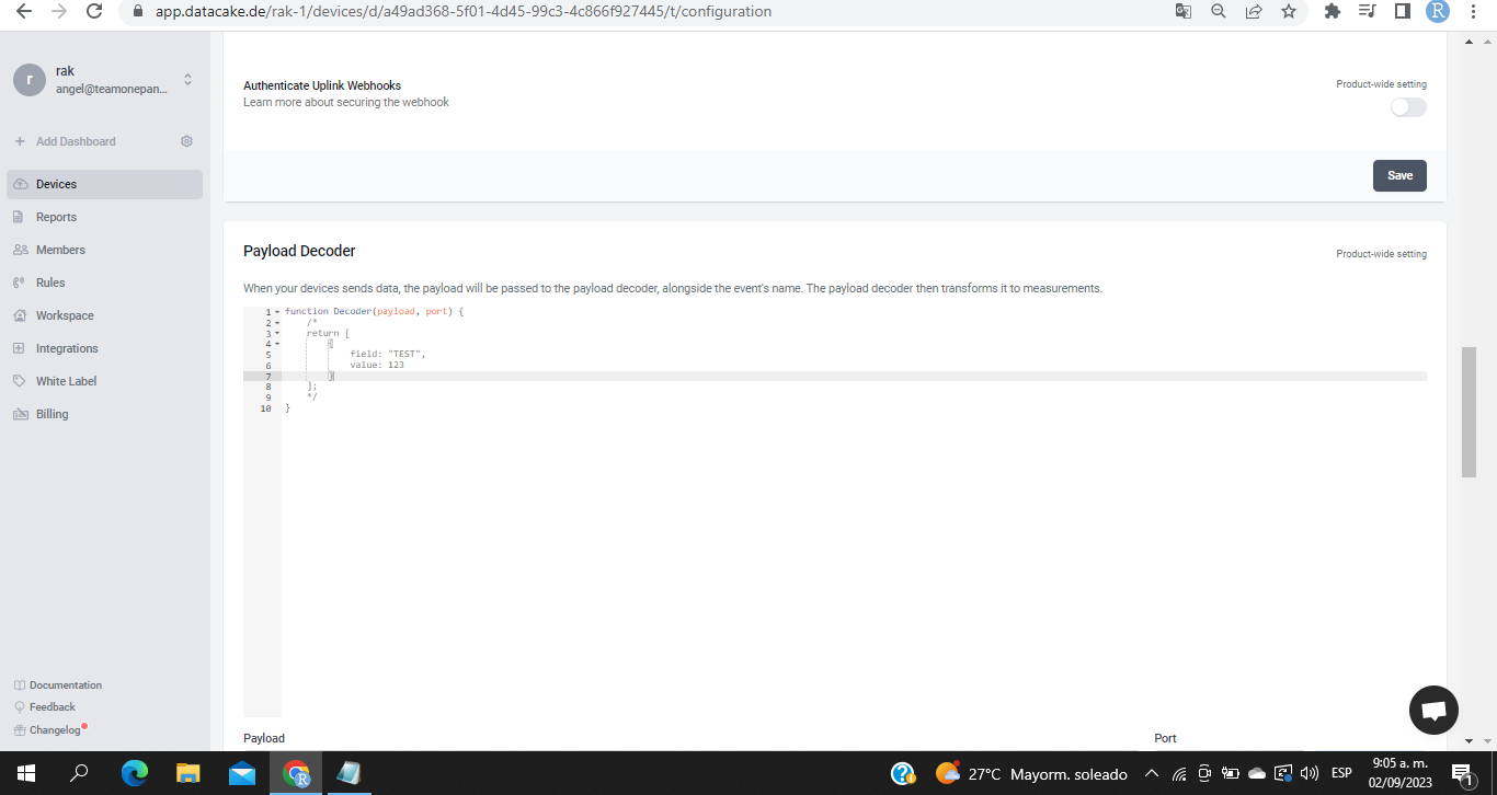
Issue:i need the decoder and the encoder of the device , Im using datacake integration directly from ttn just because i cant download chisptack but in the manual just have tutorial if I use chrisptack , i need help please
do you have the correct decoder from that part
carlrowan
February 9, 2023, 11:38pm
2
Welcome to RAK forum @roby ,
You can use this decoder in TTN.
function Decoder(bytes, port) {
	var decoded = {};
	// avoid sending Downlink ACK to integration (Cargo)
	if (port === 1) {
		var lonSign = (bytes[0] >> 7) & 0x01 ? -1 : 1;
		var latSign = (bytes[0] >> 6) & 0x01 ? -1 : 1;

		var encLat = ((bytes[0] & 0x3f) << 17) +
			(bytes[1] << 9) +
			(bytes[2] << 1) +
			(bytes[3] >> 7);

		var encLon = ((bytes[3] & 0x7f) << 16) +
			(bytes[4] << 8) +
			bytes[5];

		var hdop = bytes[8] / 10;
		var sats = bytes[9];

		const maxHdop = 2;
		const minSats = 5;

		if ((hdop < maxHdop) && (sats >= minSats)) {
			// Send only acceptable quality of position to mappers
			decoded.latitude = latSign * (encLat * 108 + 53) / 10000000;
			decoded.longitude = lonSign * (encLon * 215 + 107) / 10000000;
			decoded.altitude = ((bytes[6] << 8) + bytes[7]) - 1000;
			decoded.accuracy = (hdop * 5 + 5) / 10
			decoded.hdop = hdop;
			decoded.sats = sats;
		} else {
			decoded.error = "Need more GPS precision (hdop must be <" + maxHdop +
				" & sats must be >= " + minSats + ") current hdop: " + hdop + " & sats:" + sats;
		}
		return decoded;
	}
	return null;
}
roby
February 10, 2023, 2:01pm
3
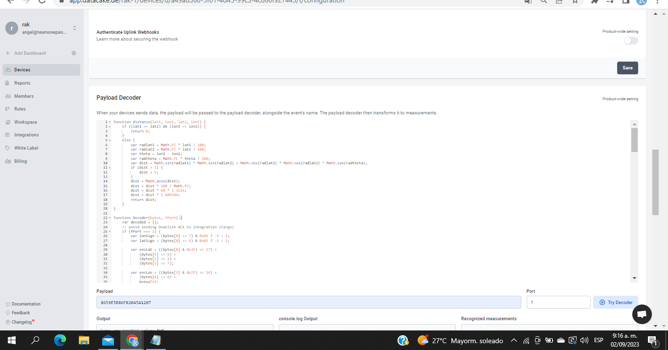
yes actually I have that for tnt , but i have this code that i have to put in datacake payload and isn’t not working as well
in the steps of the manual i have to use that
but is not working on datacake
this is the code:
function distance(lat1, lon1, lat2, lon2) {
if ((lat1 == lat2) && (lon1 == lon2)) {
return 0;
}
else {
var radlat1 = Math.PI * lat1 / 180;
var radlat2 = Math.PI * lat2 / 180;
var theta = lon1 - lon2;
var radtheta = Math.PI * theta / 180;
var dist = Math.sin(radlat1) * Math.sin(radlat2) + Math.cos(radlat1) * Math.cos(radlat2) * Math.cos(radtheta);
if (dist > 1) {
dist = 1;
}
dist = Math.acos(dist);
dist = dist * 180 / Math.PI;
dist = dist * 60 * 1.1515;
dist = dist * 1.609344;
return dist;
}
}
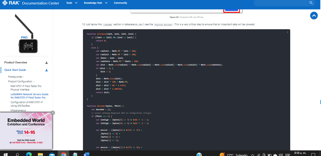
function Decoder(bytes, fPort) {
var decoded = {};
// avoid sending Downlink ACK to integration (Cargo)
if (fPort === 1) {
var lonSign = (bytes[0] >> 7) & 0x01 ? -1 : 1;
var latSign = (bytes[0] >> 6) & 0x01 ? -1 : 1;
var encLat = ((bytes[0] & 0x3f) << 17) +
(bytes[1] << 9) +
(bytes[2] << 1) +
(bytes[3] >> 7);
var encLon = ((bytes[3] & 0x7f) << 16) +
(bytes[4] << 8) +
bytes[5];
var hdop = bytes[8] / 10;
var sats = bytes[9];
var maxHdop = 2;
var minSats = 5;
if ((hdop < maxHdop) && (sats >= minSats)) {
// Send only acceptable quality of position to mappers
decoded.latitude = latSign * (encLat * 108 + 53) / 10000000;
decoded.longitude = lonSign * (encLon * 215 + 107) / 10000000;
decoded.altitude = ((bytes[6] << 8) + bytes[7]) - 1000;
decoded.accuracy = (hdop * 5 + 5) / 10
decoded.hdop = hdop;
decoded.sats = sats;
decoded.location = "(" + decoded.latitude + "," + decoded.longitude + ")";
} else {
decoded.error = "Need more GPS precision (hdop must be <" + maxHdop +
" & sats must be >= " + minSats + ") current hdop: " + hdop + " & sats:" + sats;
decoded.latitude = latSign * (encLat * 108 + 53) / 10000000;
decoded.longitude = lonSign * (encLon * 215 + 107) / 10000000;
decoded.altitude = ((bytes[6] << 8) + bytes[7]) - 1000;
decoded.accuracy = (hdop * 5 + 5) / 10
decoded.hdop = hdop;
decoded.sats = sats;
decoded.location = "(" + decoded.latitude + "," + decoded.longitude + ")";
}
// decoded.raw = rawPayload.uplink_message.rx_metadata[0].location;
decoded.num_gw = normalizedPayload.gateways.length;
decoded.minRSSI = 0;
decoded.maxRSSI = 0;
decoded.minSNR = 0;
decoded.maxSNR = 0;
decoded.minDistance = 0;
decoded.maxDistance = 0;
var server_type = 0;
// Check if payload comes from TTN
if (typeof (rawPayload.uplink_message) != "undefined") {
console.log("Found TTN format");
server_type = 1;
}
// Check if payload comes from Helium
else if (typeof (rawPayload.hotspots) != "undefined") {
console.log("Found Helium format");
server_type = 2;
}
// Check if payload comes from Chirpstack
else if (typeof (rawPayload.rxInfo) != "undefined") {
console.log("Found Chirpstack format");
server_type = 3;
decoded.is_chirpstack = 1;
}
else {
console.log("Unknown raw format");
}
var gw_lat = {};
var gw_long = {};
decoded.num_gw = 0;
for (idx_tst = 0; idx_tst < 10; idx_tst++)
{
if (typeof (normalizedPayload.gateways[idx_tst]) != "undefined")
{
console.log("Found gateway with IDX " + idx_tst);
decoded.num_gw += 1;
}
}
for (idx = 0; idx < decoded.num_gw; idx++) {
var new_rssi = (!!normalizedPayload.gateways && !!normalizedPayload.gateways[idx] && normalizedPayload.gateways[idx].rssi) || 0;
var new_snr = (!!normalizedPayload.gateways && !!normalizedPayload.gateways[idx] && normalizedPayload.gateways[idx].snr) || 0;
if ((new_rssi < decoded.minRSSI) || (decoded.minRSSI == 0)) {
decoded.minRSSI = new_rssi;
}
if ((new_rssi > decoded.maxRSSI) || (decoded.maxRSSI == 0)) {
decoded.maxRSSI = new_rssi;
}
if ((new_snr < decoded.minSNR) || (decoded.minSNR == 0)) {
decoded.minSNR = new_snr;
}
if ((new_snr > decoded.maxSNR) || (decoded.maxSNR == 0)) {
decoded.maxSNR = new_snr;
}
// var gw_lat = 0.0;
// var gw_long = 0.0;
switch (server_type) {
//TTN
case 1:
gw_lat[idx] = rawPayload.uplink_message.rx_metadata[idx].location.latitude;
gw_long[idx] = rawPayload.uplink_message.rx_metadata[idx].location.longitude;
break;
// Helium
case 2:
gw_lat[idx] = rawPayload.hotspots[idx].lat;
gw_long[idx] = rawPayload.hotspots[idx].long;
break;
// Chirpstack
case 3:
gw_lat[idx] = rawPayload.rxInfo[idx].location.latitude;
gw_long[idx] = rawPayload.rxInfo[idx].location.longitude;
break;
default:
console.log("Unknown LNS");
break;
}
console.log("IDX " + idx + " lat " + gw_lat[idx] + " long " + gw_long[idx]);
// decoded.gw_lat[idx] = gw_lat;
// decoded.gw_long[idx] = gw_long;
// Calculate distance
var new_distance = distance(gw_lat[idx], gw_long[idx], decoded.latitude, decoded.longitude);
if ((new_distance < decoded.minDistance) || (decoded.minDistance == 0)) {
decoded.minDistance = new_distance * 1000;
}
if ((new_distance > decoded.maxDistance) || (decoded.maxDistance == 0)) {
decoded.maxDistance = new_distance * 1000;
}
}
switch (decoded.num_gw) {
case 20:
decoded.hotspot_10 = "(" + gw_lat[19] + "," + gw_long[19] + ")";
case 19:
decoded.hotspot_09 = "(" + gw_lat[18] + "," + gw_long[18] + ")";
case 18:
decoded.hotspot_08 = "(" + gw_lat[17] + "," + gw_long[17] + ")";
case 17:
decoded.hotspot_07 = "(" + gw_lat[16] + "," + gw_long[16] + ")";
case 16:
decoded.hotspot_06 = "(" + gw_lat[15] + "," + gw_long[15] + ")";
case 15:
decoded.hotspot_05 = "(" + gw_lat[14] + "," + gw_long[14] + ")";
case 14:
decoded.hotspot_04 = "(" + gw_lat[13] + "," + gw_long[13] + ")";
case 13:
decoded.hotspot_03 = "(" + gw_lat[12] + "," + gw_long[12] + ")";
case 12:
decoded.hotspot_02 = "(" + gw_lat[11] + "," + gw_long[11] + ")";
case 11:
decoded.hotspot_01 = "(" + gw_lat[10] + "," + gw_long[10] + ")";
case 10:
decoded.hotspot_10 = "(" + gw_lat[9] + "," + gw_long[9] + ")";
case 9:
decoded.hotspot_09 = "(" + gw_lat[8] + "," + gw_long[8] + ")";
case 8:
decoded.hotspot_08 = "(" + gw_lat[7] + "," + gw_long[7] + ")";
case 7:
decoded.hotspot_07 = "(" + gw_lat[6] + "," + gw_long[6] + ")";
case 6:
decoded.hotspot_06 = "(" + gw_lat[5] + "," + gw_long[5] + ")";
case 5:
decoded.hotspot_05 = "(" + gw_lat[4] + "," + gw_long[4] + ")";
case 4:
decoded.hotspot_04 = "(" + gw_lat[3] + "," + gw_long[3] + ")";
case 3:
decoded.hotspot_03 = "(" + gw_lat[2] + "," + gw_long[2] + ")";
case 2:
decoded.hotspot_02 = "(" + gw_lat[1] + "," + gw_long[1] + ")";
case 1:
decoded.hotspot_01 = "(" + gw_lat[0] + "," + gw_long[0] + ")";
default:
break;
}
decoded.maxMod = parseInt((decoded.maxDistance / 250), 10);
decoded.minMod = parseInt((decoded.minDistance / 250), 10);
decoded.maxDistance = parseInt((decoded.maxMod * 250), 10);
decoded.minDistance = parseInt((decoded.minMod * 250), 10);
if (decoded.maxDistance <= 1) {
decoded.maxDistance = parseInt(250, 10);
}
if (decoded.minDistance <= 1) {
decoded.minDistance = parseInt(250, 10);
}
return decoded;
}
return null;
}

beegee
February 11, 2023, 11:22am
4
The function names in the decoder are different between TTN and Chirpstack.
For TTN, Helium and Datacake the function call in the decoder is:
// For TTN, Helium and Datacake
function Decoder(bytes, fport) {
}
For Chirpstack it is
// For Chirpstack
function Decode(fPort, bytes, variables) {
}
A possible solution is to change the decoder like this:
// For TTN, Helium and Datacake
function Decoder(bytes, fport) {
   // keep the decoding functions as they are
}
// For Chirpstack
function Decode(fPort, bytes, variables) {
   return Decoder(bytes, fport);
}
roby
February 13, 2023, 2:10pm
5
si, eso ya lo se pero lo que quiero es el codigo que debo colococar del rak10701-l en datacake porque el que tengo no funciona con todo y que coloque las funciones como me dice que tengo que usarlas , aparte necesito el encoder que va de retorno como downlink a ttn . ya que no sale en ningun lado ese codigo , pero el payload de subida si lo tengo, gracias
beegee
February 14, 2023, 2:47am
6
I am sorry, I do not understand Spanish and the Google translation doesn’t make much sense.
Yes, I already know that, but what I want is the code that I have to put the rak10701-l in datacake because the one I have doesn't work with everything and to put the functions as it tells me I have to use them, apart from that I need the encoder that goes from return as downlink to ttn . Since that code does not appear anywhere, but I do have the upload payload, thanks
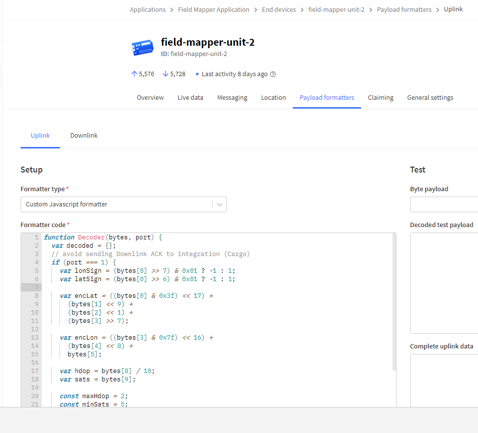
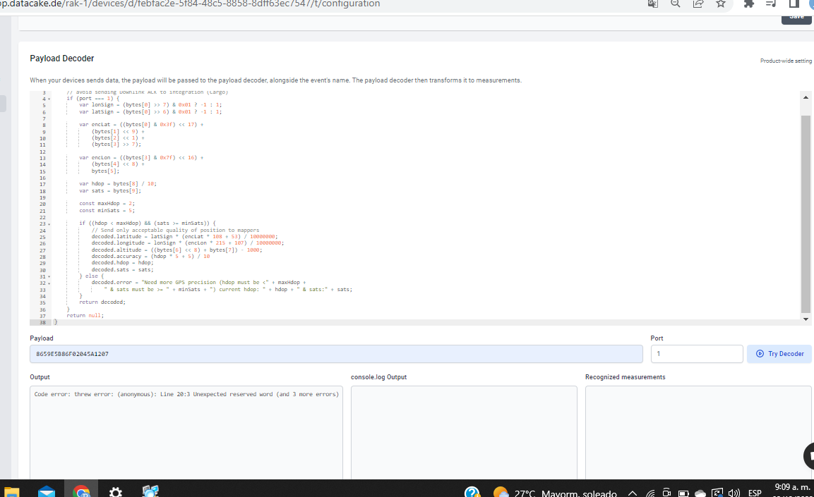
I am using the decoder from our Github repo and it is working fine on Datacake.
roby
February 14, 2023, 1:13pm
7
thanks man , have a nice valentine day
Tomo
February 28, 2024, 5:56pm
8
Hello Mr. Bernd
beegee
February 29, 2024, 2:02am
9
Welcome to the forum @Tomo
Did you try the decoder from the Github link?
Tomo
February 29, 2024, 7:46am
10
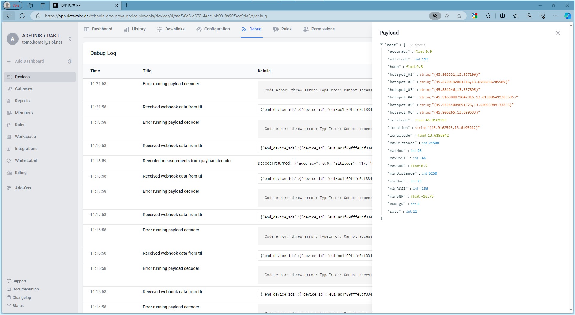
Hi Bernd…blind testing before I linked the error to the number of Gateways. I collected various payload decoders from the Datacake database, from the RAK documentation,…
Tomo
February 29, 2024, 7:50am
11
Another picture with successful decoding of 6 gateways…
Best regards, Tomo
beegee
February 29, 2024, 9:04am
12
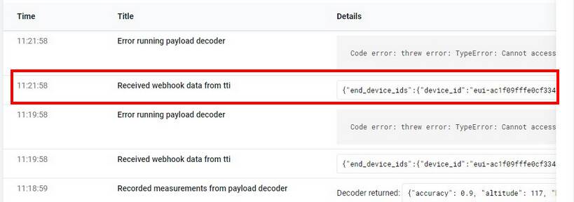
I am not sure what the problem is.
Can you give me the content of the webhook received from TTI (if possible as text, not as screenshot):
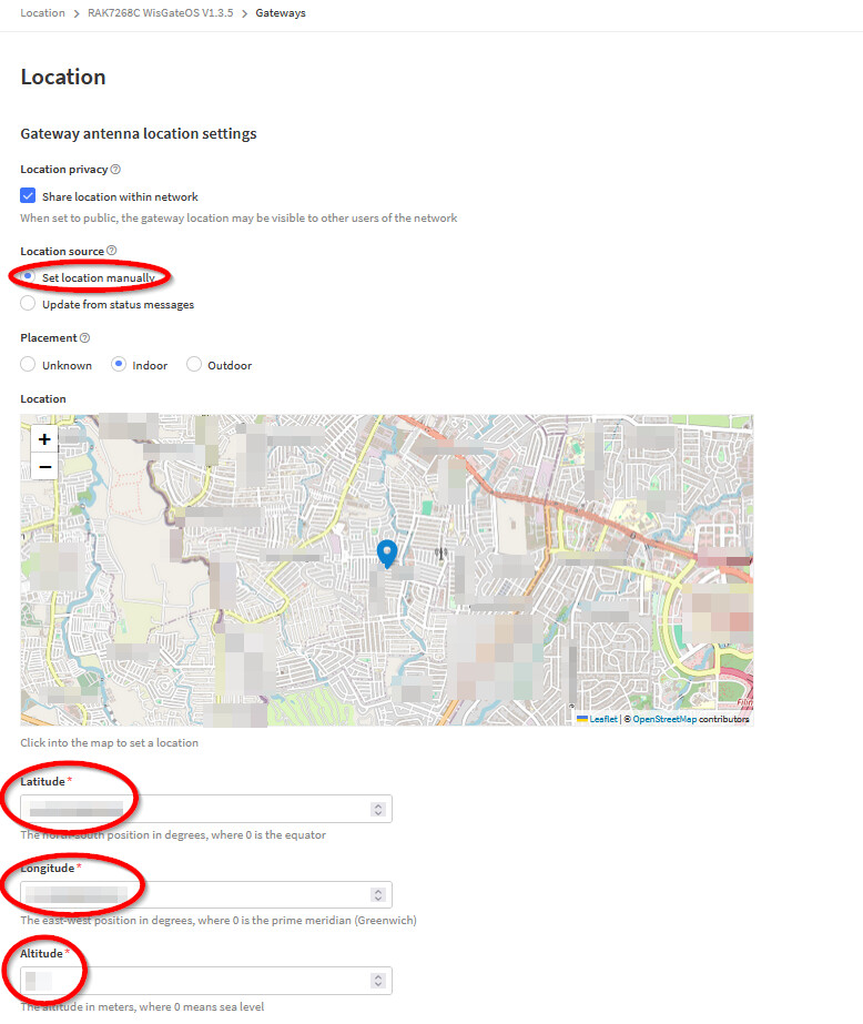
Btw, if you are using TTN/TTI, why do you not use the “native” integration RAK10701-P Field Tester Pro Guide for The Things Network ?
Tomo
February 29, 2024, 10:22am
13
Payload
"root":**{**

*4 items*

"end_device_ids":**{**

*5 items*

"device_id":

string"eui-ac1f09fffe0cf334"

"application_ids":**{**

*1 item*

"application_id":

string"x-xxxxtester"

**}**

"dev_eui":

string"AC1F09FFFE0CF334"

"join_eui":

string"AC1F0xxxF8680701"

"dev_addr":

string"260B0E2B"

**}**

"correlation_ids":**[**

*1 item*

0

:

string"gs:uplink:01HQT5SHJQ61EGS1DHDVCJ2D9M"

**]**

"received_at":

string"2024-02-29T10:15:37.523088186Z"

"uplink_message":**{**

*12 items*

"session_key_id":

string"AY30VTxxxTka4+CZuqu2Zg=="

"f_port":

int1

"f_cnt":

int7

"frm_payload":

string"IG+9iaqFBFoNCw=="

"decoded_payload":**{**

*6 items*

"accuracy":

float1.15

"altitude":

int114

"hdop":

float1.3

"latitude":

float45.9163673

"longitude":

float13.6197662

"sats":

int11

**}**

"rx_metadata":**[**

*5 items*

0:**{**

*8 items*

"gateway_ids":**{**

*2 items*

"gateway_id":

string"san-floriano-del-collio"

"eui":

string"C0EE40FFFF296845"

**}**

"timestamp":

int492264100

"rssi":

int-111

"channel_rssi":

int-111

"snr":

float4.8

"uplink_token":

string"CiUKIwoXc2FuLWZsb3JpYW5vLWRlbC1jb2xsaW8SCMDuQP//KWhFEKS13eoBGgwIybKBrwYQ5p3XkAEgoKHo6anYEQ=="

"channel_index":

int3

"received_at":

string"2024-02-29T10:15:37.279754341Z"

**}**

1:**{**

*9 items*

"gateway_ids":**{**

*2 items*

"gateway_id":

string"xiris-gw-5292-01"

"eui":

string"24E124FFFEF4761A"

**}**

"time":

string"2024-02-29T10:15:37.245135068Z"

"timestamp":

float3951399705

"rssi":

int-122

"channel_rssi":

int-122

"snr":

int-4

"location":**{**

*4 items*

"latitude":

float45.8720192861716

"longitude":

float13.6568936705589

"altitude":

int208

"source":

string"SOURCE_REGISTRY"

**}**

"uplink_token":

string"Ch4KHAoQeGlyaXMtZ3ctNTI5Mi0wMRIIJOEk//70dhoQmaaW3A4aDAjJsoGvBhDJgPeSASCos5qOgMAR"

"received_at":

string"2024-02-29T10:15:37.284598634Z"

**}**

2:**{**

*9 items*

"gateway_ids":**{**

*2 items*

"gateway_id":

string"xiris-gw-5290-01"

"eui":

string"B827EBFFFE1F43CC"

**}**

"time":

string"2024-02-29T10:15:36.065701961Z"

"timestamp":

float3985017676

"rssi":

int-46

"channel_rssi":

int-46

"snr":

float9.5

"location":**{**

*4 items*

"latitude":

float45.916388872042916

"longitude":

float13.619886492385595

"altitude":

int60

"source":

string"SOURCE_REGISTRY"

**}**

"uplink_token":

string"Ch4KHAoQeGlyaXMtZ3ctNTI5MC0wMRIIuCfr//4fQ8wQzJaa7A4aDAjJsoGvBhC4oKWUASDgwcCs/cAR"

"received_at":

string"2024-02-29T10:15:37.289082311Z"

**}**

3:**{**

*9 items*

"gateway_ids":**{**

*2 items*

"gateway_id":

string"xiris-gw-5293-01"

"eui":

string"24E124FFFEF47588"

**}**

"time":

string"2024-02-29T10:15:37.246973037Z"

"timestamp":

float3959256077

"rssi":

int-134

"channel_rssi":

int-134

"snr":

int-14

"location":**{**

*4 items*

"latitude":

float45.906265

"longitude":

float13.699533

"altitude":

int110

"source":

string"SOURCE_REGISTRY"

**}**

"uplink_token":

string"Ch4KHAoQeGlyaXMtZ3ctNTI5My0wMRIIJOEk//70dYgQjej13w4aDAjJsoGvBhC2oqqUASDIpbWwncAR"

"received_at":

string"2024-02-29T10:15:37.284852113Z"

**}**

4:**{**

*9 items*

"gateway_ids":**{**

*2 items*

"gateway_id":

string"75-gw-5000-01"

"eui":

string"B827EBFFFED3C6EE"

**}**

"time":

string"2024-02-29T10:15:37.252624034Z"

"timestamp":

float3983704604

"rssi":

int-120

"channel_rssi":

int-120

"snr":

float-16.75

"location":**{**

*4 items*

"latitude":

float45.94244009091676

"longitude":

float13.64093989133835

"altitude":

int80

"source":

string"SOURCE_REGISTRY"

**}**

"uplink_token":

string"ChsKGQoNNzUtZ3ctNTAwMC0wMRIIuCfr//7Txu4QnITK6w4aDAjJsoGvBhCnm7ybASDg+rC6+MAR"

"received_at":

string"2024-02-29T10:15:37.295647268Z"

**}**

**]**

"settings":**{**

*3 items*

"data_rate":**{**

*1 item*

"lora":**{**

*3 items*

"bandwidth":

int125000

"spreading_factor":

int10

"coding_rate":

string"4/5"

**}**

**}**

"frequency":

string"867100000"

"timestamp":

int492264100

**}**

"received_at":

string"2024-02-29T10:15:37.304076006Z"

"confirmed":

booltrue

"consumed_airtime":

string"0.370688s"

"locations":**{**

*1 item*

"frm-payload":**{**

*5 items*

"latitude":

float45.9163673

"longitude":

float13.6197662

"altitude":

int114

"accuracy":

int1

"source":

string"SOURCE_GPS"

**}**

**}**

"network_ids":**{**

*5 items*

"net_id":

string"000013"

"ns_id":

string"EC656E0000000181"

"tenant_id":

string"ttn"

"cluster_id":

string"eu1"

"cluster_address":

string"eu1.cloud.thethings.network"

**}**

**}**

**}**
beegee
February 29, 2024, 11:21am
14
I think I found it.
			"0": {
				"gateway_ids": {
					"gateway_id": "san-floriano-del-collio",
					"eui": "C0EE40FFFF296845"
				},
				"timestamp": 492264100,
				"rssi": -111,
				"channel_rssi": -111,
				"snr": 4.8,
				"uplink_token": "CiUKIwoXc2FuLWZsb3JpYW5vLWRlbC1jb2xsaW8SCMDuQP//KWhFEKS13eoBGgwIybKBrwYQ5p3XkAEgoKHo6anYEQ==",
				"channel_index": 3,
				"received_at": "2024-02-29T10:15:37.279754341Z"
			},
Others have the location information
			"1": {
				"gateway_ids": {
					"gateway_id": "xiris-gw-5292-01",
					"eui": "24E124FFFEF4761A"
				},
				"time": "2024-02-29T10:15:37.245135068Z",
				"timestamp": 3951399705,
				"rssi": -122,
				"channel_rssi": -122,
				"snr": -4,
				"location": {
					"latitude": 45.8720192861716,
					"longitude": 13.6568936705589,
					"altitude": 208,
					"source": "SOURCE_REGISTRY"
				},
				"uplink_token": "Ch4KHAoQeGlyaXMtZ3ctNTI5Mi0wMRIIJOEk//70dhoQmaaW3A4aDAjJsoGvBhDJgPeSASCos5qOgMAR",
				"received_at": "2024-02-29T10:15:37.284598634Z"
			},
Can you try the attached updated decoder, I cannot really test, all my gateways have location info.
test-decoder.zip (1.8 KB)
beegee
February 29, 2024, 11:25am
15
Another workaround would be to make sure all gateways report a location or have a “fake” location assigned in TTN in the gateway settings.
1 Like