Hello,
I still haven’t been able to display data on my Field Tester Pro.
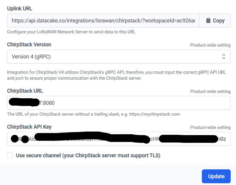
I am using chirpstack and datacake.
Please see all details - Steps from tester guide and also copied updated decoders from RakWireless Github.
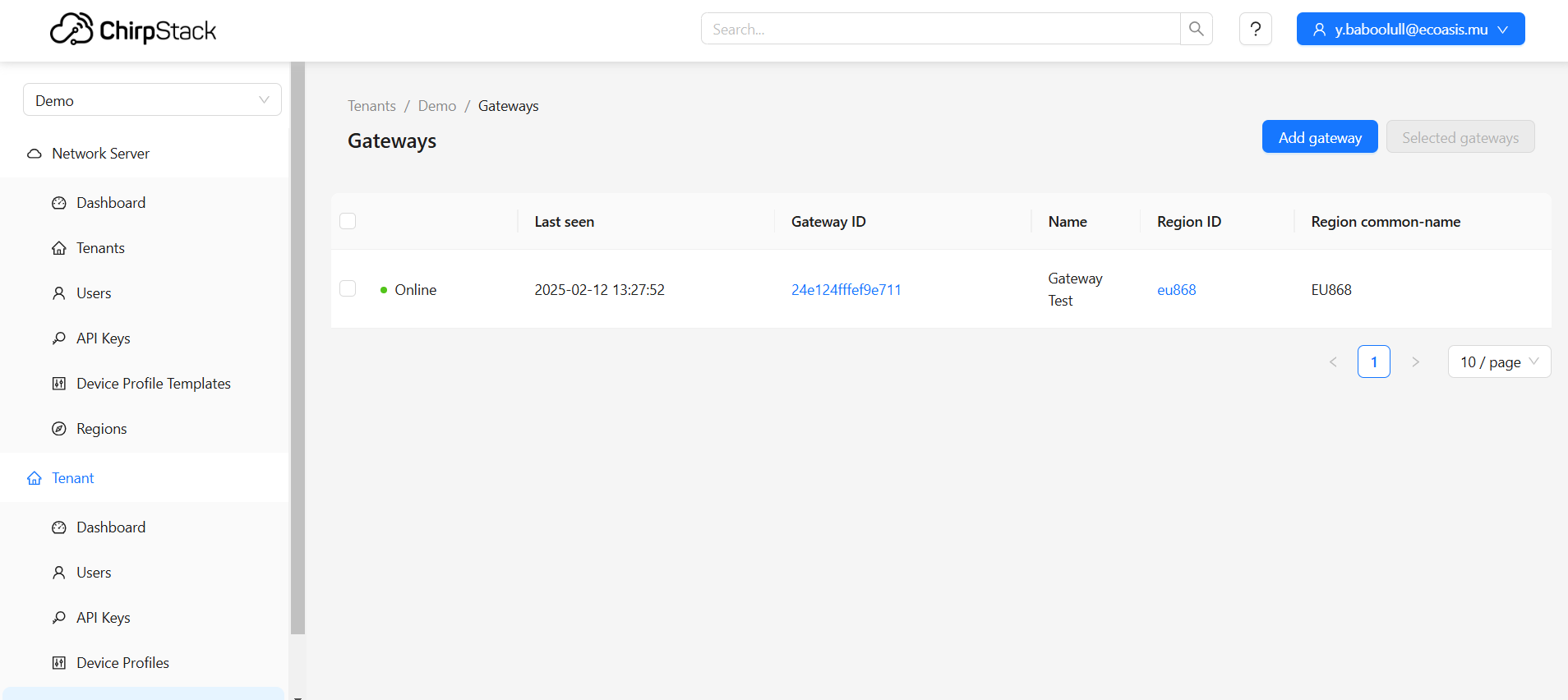
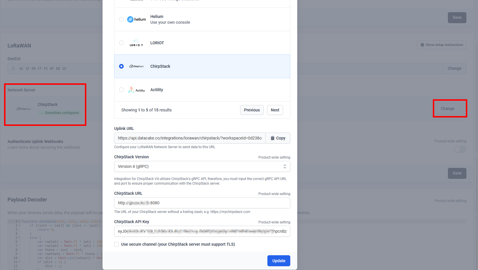
My Gateway on Chirpstack:
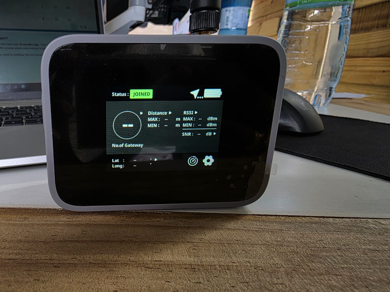
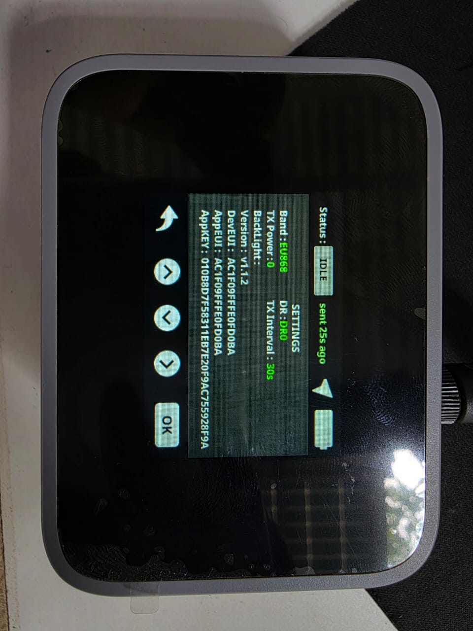
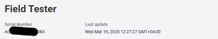
Field Tester:
Codec in Chirpstack:
// Decode decodes an array of bytes into an object.
//  - fPort contains the LoRaWAN fPort number
//  - bytes is an array of bytes, e.g. [225, 230, 255, 0]
//  - variables contains the device variables e.g. {"calibration": "3.5"} (both the key / value are of type string)
// The function must return an object, e.g. {"temperature": 22.5}
function Decode(fPort, bytes, variables) {
	var decoded = {};
	// avoid sending Downlink ACK to integration (Cargo)
	if (fPort === 1) {
		var lonSign = (bytes[0] >> 7) & 0x01 ? -1 : 1;
		var latSign = (bytes[0] >> 6) & 0x01 ? -1 : 1;

		var encLat = ((bytes[0] & 0x3f) << 17) +
			(bytes[1] << 9) +
			(bytes[2] << 1) +
			(bytes[3] >> 7);

		var encLon = ((bytes[3] & 0x7f) << 16) +
			(bytes[4] << 8) +
			bytes[5];

		var hdop = bytes[8] / 10;
		var sats = bytes[9];

		var maxHdop = 2;
		var minSats = 5;

		if ((hdop < maxHdop) && (sats >= minSats)) {
			// Send only acceptable quality of position to mappers
			decoded.latitude = latSign * (encLat * 108 + 53) / 10000000;
			decoded.longitude = lonSign * (encLon * 215 + 107) / 10000000;
			decoded.altitude = ((bytes[6] << 8) + bytes[7]) - 1000;
			decoded.accuracy = (hdop * 5 + 5) / 10
			decoded.hdop = hdop;
			decoded.sats = sats;
		} else {
			decoded.error = "Need more GPS precision (hdop must be <" + maxHdop +
				" & sats must be >= " + minSats + ") current hdop: " + hdop + " & sats:" + sats;
			decoded.latitude = latSign * (encLat * 108 + 53) / 10000000;
			decoded.longitude = lonSign * (encLon * 215 + 107) / 10000000;
			decoded.altitude = ((bytes[6] << 8) + bytes[7]) - 1000;
			decoded.accuracy = (hdop * 5 + 5) / 10
			decoded.hdop = hdop;
			decoded.sats = sats;
		}
		return decoded;
	}
	return null;

}


// Chirpstack v3 to v4 compatibility wrapper
function decodeUplink(input) {
	return {
		data: Decode(input.fPort, input.bytes, input.variables)
	};
}
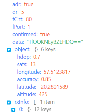
Sample uplink:
{
        "deduplicationId": "89d1ee68-9353-4e94-b2fe-f5a9a21abbf9",
        "time": "2025-02-12T10:01:33.445+00:00",
        "deviceInfo": {
            "tenantId": "ea6ab5f4-ad75-40c5-9a56-093ab4089ffc",
            "tenantName": "Demo",
            "applicationId": "ee4a686c-7191-478a-a6ce-afc675d9c22e",
            "applicationName": "Field Tester",
            "deviceProfileId": "3c243fe9-cffd-4275-9c20-f1f64313f8d8",
            "deviceProfileName": "RakWireless Field Tester",
            "deviceName": "Field Tester",
            "devEui": "ac1f09fffe0fd0ba",
            "deviceClassEnabled": "CLASS_A",
            "tags": {}
        },
        "devAddr": "0150ddbe",
        "adr": true,
        "dr": 5,
        "fCnt": 53,
        "fPort": 1,
        "confirmed": true,
        "data": "TlONKNE3BZsHDQ==",
        "object": {
            "longitude": 57.5124892,
            "accuracy": 0.85,
            "altitude": 435,
            "latitude": -20.2800941,
            "sats": 13,
            "hdop": 0.7
        },
        "rxInfo": [
            {
                "gatewayId": "24e124fffef9e711",
                "uplinkId": 11034,
                "gwTime": "2025-02-12T10:01:33.445062+00:00",
                "nsTime": "2025-02-12T10:01:33.566017330+00:00",
                "timeSinceGpsEpoch": "1423389711.445s",
                "rssi": -97,
                "snr": 12.5,
                "channel": 7,
                "location": {
                    "latitude": -20.28009,
                    "longitude": 57.51255,
                    "altitude": 432
                },
                "context": "fBIWPQ==",
                "metadata": {
                    "region_config_id": "eu868",
                    "region_common_name": "EU868"
                },
                "crcStatus": "CRC_OK"
            }
        ],
        "txInfo": {
            "frequency": 867900000,
            "modulation": {
                "lora": {
                    "bandwidth": 125000,
                    "spreadingFactor": 7,
                    "codeRate": "CR_4_5"
                }
            }
        }
    }
Payload Decoder in DataCake:
function distance(lat1, lon1, lat2, lon2) {
    if ((lat1 == lat2) && (lon1 == lon2)) {
        return 0;
    }
    else {
        var radlat1 = Math.PI * lat1 / 180;
        var radlat2 = Math.PI * lat2 / 180;
        var theta = lon1 - lon2;
        var radtheta = Math.PI * theta / 180;
        var dist = Math.sin(radlat1) * Math.sin(radlat2) + Math.cos(radlat1) * Math.cos(radlat2) * Math.cos(radtheta);
        if (dist > 1) {
            dist = 1;
        }
        dist = Math.acos(dist);
        dist = dist * 180 / Math.PI;
        dist = dist * 60 * 1.1515;
        dist = dist * 1.609344;
        return dist;
    }
}

function Decoder(bytes, fPort) {
    var decoded = {};
    // avoid sending Downlink ACK to integration (Cargo)
    if (fPort === 1) {
        var lonSign = (bytes[0] >> 7) & 0x01 ? -1 : 1;
        var latSign = (bytes[0] >> 6) & 0x01 ? -1 : 1;

        var encLat = ((bytes[0] & 0x3f) << 17) +
            (bytes[1] << 9) +
            (bytes[2] << 1) +
            (bytes[3] >> 7);

        var encLon = ((bytes[3] & 0x7f) << 16) +
            (bytes[4] << 8) +
            bytes[5];

        var hdop = bytes[8] / 10;
        var sats = bytes[9];

        var maxHdop = 2;
        var minSats = 5;

        if ((hdop < maxHdop) && (sats >= minSats)) {
            // Send only acceptable quality of position to mappers
            decoded.latitude = latSign * (encLat * 108 + 53) / 10000000;
            decoded.longitude = lonSign * (encLon * 215 + 107) / 10000000;
            decoded.altitude = ((bytes[6] << 8) + bytes[7]) - 1000;
            decoded.accuracy = (hdop * 5 + 5) / 10
            decoded.hdop = hdop;
            decoded.sats = sats;
            decoded.location = "(" + decoded.latitude + "," + decoded.longitude + ")";
        } else {
            decoded.error = "Need more GPS precision (hdop must be <" + maxHdop +
                " & sats must be >= " + minSats + ") current hdop: " + hdop + " & sats:" + sats;
            decoded.latitude = latSign * (encLat * 108 + 53) / 10000000;
            decoded.longitude = lonSign * (encLon * 215 + 107) / 10000000;
            decoded.altitude = ((bytes[6] << 8) + bytes[7]) - 1000;
            decoded.accuracy = (hdop * 5 + 5) / 10
            decoded.hdop = hdop;
            decoded.sats = sats;
            decoded.location = "(" + decoded.latitude + "," + decoded.longitude + ")";
        }
        //      decoded.raw = rawPayload.uplink_message.rx_metadata[0].location;
        decoded.num_gw = normalizedPayload.gateways.length;
        decoded.minRSSI = 0;
        decoded.maxRSSI = 0;
        decoded.minSNR = 0;
        decoded.maxSNR = 0;
        decoded.minDistance = 0;
        decoded.maxDistance = 0;

        var server_type = 0;
        // Check if payload comes from TTN
        if (typeof (rawPayload.uplink_message) != "undefined") {
            console.log("Found TTN format");
            server_type = 1;
        }
        // Check if payload comes from Helium
        else if (typeof (rawPayload.hotspots) != "undefined") {
            console.log("Found Helium format");
            server_type = 2;
        }
        // Check if payload comes from Chirpstack
        else if (typeof (rawPayload.rxInfo) != "undefined") {
            console.log("Found Chirpstack format");
            server_type = 3;
            decoded.is_chirpstack = 1;
        }
        else {
            console.log("Unknown raw format");
        }

        var gw_lat = {};
        var gw_long = {};

        decoded.num_gw = 0;
        for (idx_tst = 0; idx_tst < 10; idx_tst++)
        {
            if (typeof (normalizedPayload.gateways[idx_tst]) != "undefined")
            {
                console.log("Found gateway with IDX " + idx_tst);
                decoded.num_gw += 1;
            }
        }

        for (idx = 0; idx < decoded.num_gw; idx++) {
            var new_rssi = (!!normalizedPayload.gateways && !!normalizedPayload.gateways[idx] && normalizedPayload.gateways[idx].rssi) || 0;
            var new_snr = (!!normalizedPayload.gateways && !!normalizedPayload.gateways[idx] && normalizedPayload.gateways[idx].snr) || 0;
            if ((new_rssi < decoded.minRSSI) || (decoded.minRSSI == 0)) {
                decoded.minRSSI = new_rssi;
            }
            if ((new_rssi > decoded.maxRSSI) || (decoded.maxRSSI == 0)) {
                decoded.maxRSSI = new_rssi;
            }
            if ((new_snr < decoded.minSNR) || (decoded.minSNR == 0)) {
                decoded.minSNR = new_snr;
            }
            if ((new_snr > decoded.maxSNR) || (decoded.maxSNR == 0)) {
                decoded.maxSNR = new_snr;
            }

            // var gw_lat = 0.0;
            // var gw_long = 0.0;
            switch (server_type) {
                //TTN
                case 1:
                    gw_lat[idx] = rawPayload.uplink_message.rx_metadata[idx].location.latitude;
                    gw_long[idx] = rawPayload.uplink_message.rx_metadata[idx].location.longitude;
                    break;
                // Helium
                case 2:
                    gw_lat[idx] = rawPayload.hotspots[idx].lat;
                    gw_long[idx] = rawPayload.hotspots[idx].long;
                    break;
                // Chirpstack
                case 3:
                    gw_lat[idx] = rawPayload.rxInfo[idx].location.latitude;
                    gw_long[idx] = rawPayload.rxInfo[idx].location.longitude;
                    break;
                default:
                    console.log("Unknown LNS");
                    break;
            }

            console.log("IDX " + idx + " lat " + gw_lat[idx] + " long " + gw_long[idx]);
            // decoded.gw_lat[idx] = gw_lat;
            // decoded.gw_long[idx] = gw_long;

            // Calculate distance
            var new_distance = distance(gw_lat[idx], gw_long[idx], decoded.latitude, decoded.longitude);
            if ((new_distance < decoded.minDistance) || (decoded.minDistance == 0)) {
                decoded.minDistance = new_distance * 1000;
            }
            if ((new_distance > decoded.maxDistance) || (decoded.maxDistance == 0)) {
                decoded.maxDistance = new_distance * 1000;
            }
        }

        switch (decoded.num_gw) {
            case 20:
                decoded.hotspot_10 = "(" + gw_lat[19] + "," + gw_long[19] + ")";
            case 19:
                decoded.hotspot_09 = "(" + gw_lat[18] + "," + gw_long[18] + ")";
            case 18:
                decoded.hotspot_08 = "(" + gw_lat[17] + "," + gw_long[17] + ")";
            case 17:
                decoded.hotspot_07 = "(" + gw_lat[16] + "," + gw_long[16] + ")";
            case 16:
                decoded.hotspot_06 = "(" + gw_lat[15] + "," + gw_long[15] + ")";
            case 15:
                decoded.hotspot_05 = "(" + gw_lat[14] + "," + gw_long[14] + ")";
            case 14:
                decoded.hotspot_04 = "(" + gw_lat[13] + "," + gw_long[13] + ")";
            case 13:
                decoded.hotspot_03 = "(" + gw_lat[12] + "," + gw_long[12] + ")";
            case 12:
                decoded.hotspot_02 = "(" + gw_lat[11] + "," + gw_long[11] + ")";
            case 11:
                decoded.hotspot_01 = "(" + gw_lat[10] + "," + gw_long[10] + ")";
            case 10:
                decoded.hotspot_10 = "(" + gw_lat[9] + "," + gw_long[9] + ")";
            case 9:
                decoded.hotspot_09 = "(" + gw_lat[8] + "," + gw_long[8] + ")";
            case 8:
                decoded.hotspot_08 = "(" + gw_lat[7] + "," + gw_long[7] + ")";
            case 7:
                decoded.hotspot_07 = "(" + gw_lat[6] + "," + gw_long[6] + ")";
            case 6:
                decoded.hotspot_06 = "(" + gw_lat[5] + "," + gw_long[5] + ")";
            case 5:
                decoded.hotspot_05 = "(" + gw_lat[4] + "," + gw_long[4] + ")";
            case 4:
                decoded.hotspot_04 = "(" + gw_lat[3] + "," + gw_long[3] + ")";
            case 3:
                decoded.hotspot_03 = "(" + gw_lat[2] + "," + gw_long[2] + ")";
            case 2:
                decoded.hotspot_02 = "(" + gw_lat[1] + "," + gw_long[1] + ")";
            case 1:
                decoded.hotspot_01 = "(" + gw_lat[0] + "," + gw_long[0] + ")";
            default:
                break;
        }

        decoded.maxMod = parseInt((decoded.maxDistance / 250), 10);
        decoded.minMod = parseInt((decoded.minDistance / 250), 10);
        decoded.maxDistance = parseInt((decoded.maxMod * 250), 10);
        decoded.minDistance = parseInt((decoded.minMod * 250), 10);
        if (decoded.maxDistance <= 1) {
            decoded.maxDistance = parseInt(250, 10);
        }
        if (decoded.minDistance <= 1) {
            decoded.minDistance = parseInt(250, 10);
        }
        return decoded;
    }
    return null;

}
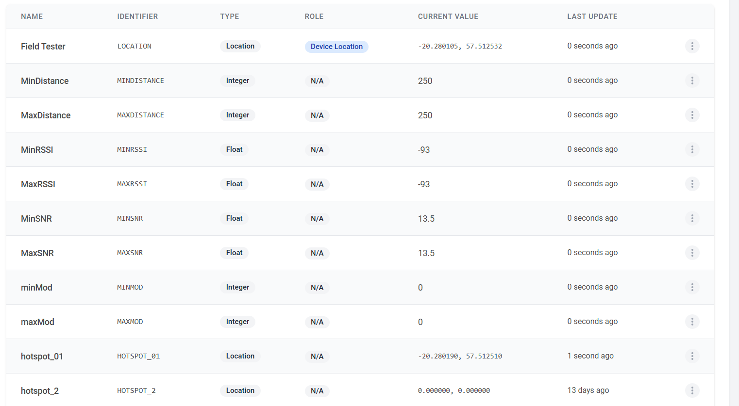
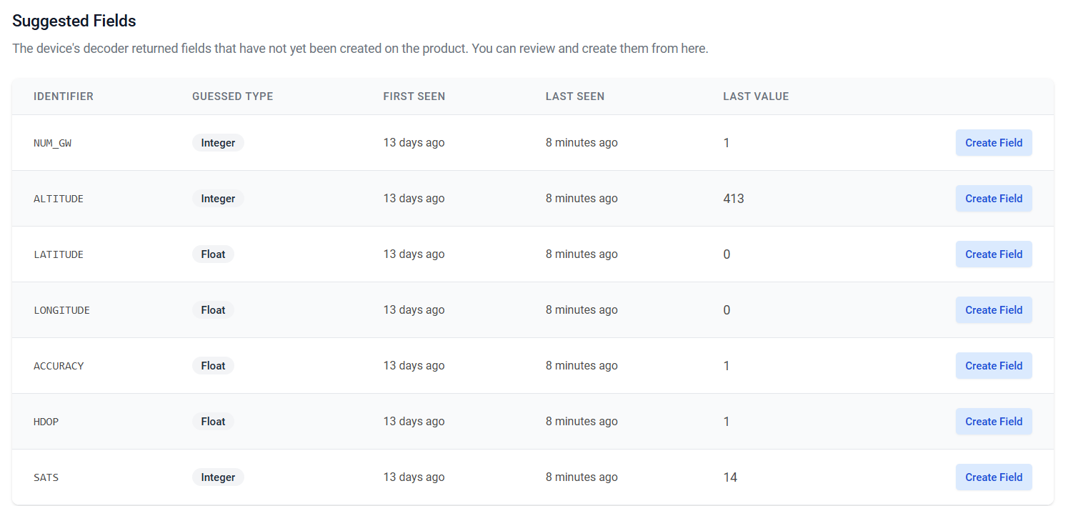
DataCake Fields:
Downlink Encoder in Datacake downlink:
function Encoder(measurements, port) {
    var buf = [];
    buf[0] = 1;
    buf[1] = measurements.MINRSSI.value + 200;
    buf[2] = measurements.MAXRSSI.value + 200;
    // var temp = parseInt(measurements.MINMOD.value,10);
    if (measurements.MINMOD.value == 0) {
        measurements.MINMOD.value = 1;
    }
    console.log(measurements.MINMOD.value);
    buf[3] = measurements.MINMOD.value;
    if (measurements.MAXMOD.value == 0) {
        measurements.MAXMOD.value = 1;
    }
    buf[4] = measurements.MAXMOD.value;
    buf[5] = measurements.NUM_GW.value;
    return buf;
}
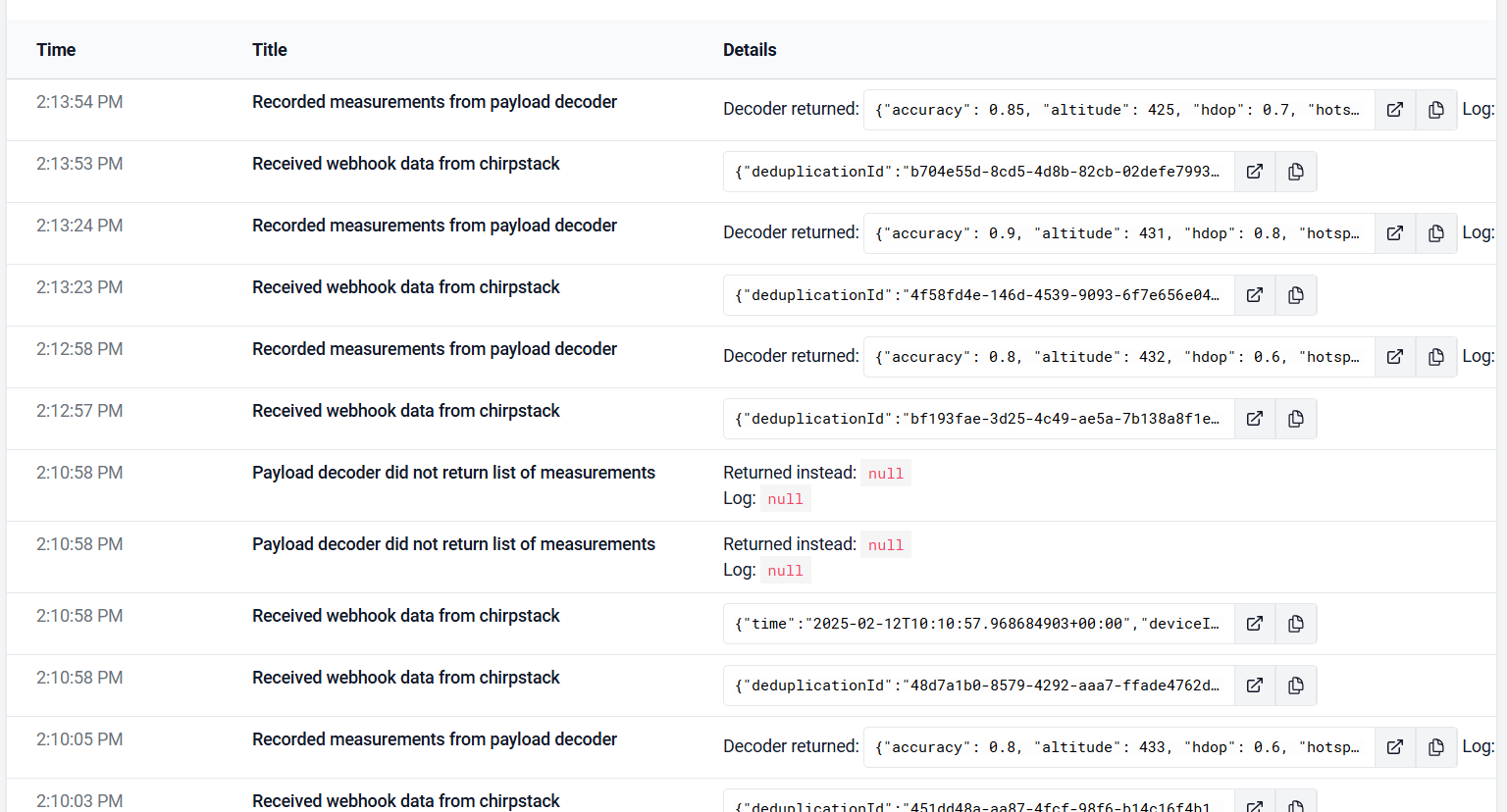
Debug Log in DataCake:
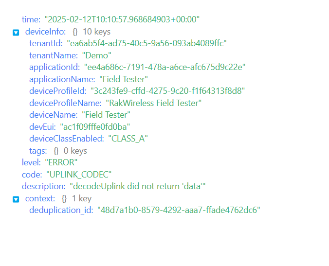
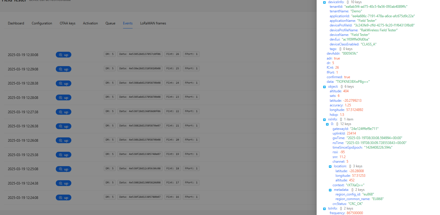
Sometimes, I receive this error in chirpstack:
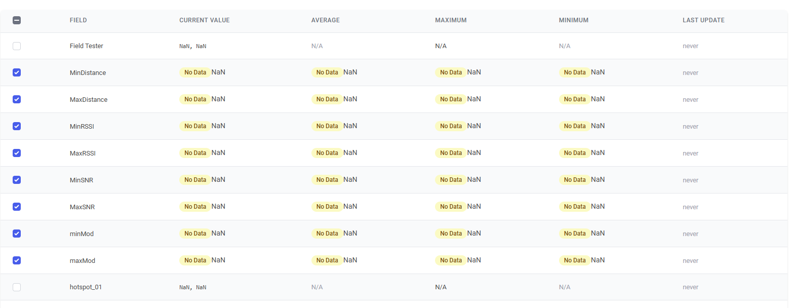
The only data I can see on Chirpstack are:
Kindly advise if I am doing something wrong.