Basically we are testing this theory in a months time
I am on holidays now when i get back on monday i will write a full technical description of the project 
Basically we are testing this theory in a months time
I am on holidays now when i get back on monday i will write a full technical description of the project
That will be great!
We’re looking forward for it. 
Good think to take of, however a potential problem too.
Means one more radio, one more antenna, considering you already have several patches for the different LoRa Bands.
You could group them in LF and HF and just use 2 antennas, however they will be slightly de-tuned for all frequencies essentially. However depending on your link budget this might be the best solution, as you are space constrained. GPS got to be circular pol so no running away there.
So those are already 3 antennas just for LoRa and GPS, am I right?
Also as MR. @BoRRoZ pointed out the RAK5205 does have integrated GPS, but it might not be the best option as there are sensors that might not be needed and if you are going to modify it heavily anyway might as swell use a RAK811 with a GPS radio.
I am a fan of simple is better, so the less there is the more likelly it is not to blow up in your face, ahaha.
maybe you can make a carrier board for the 811 with an arduino nano to take care of the AT commands and a TPL5110 and an FRAM for the data. Yes I am going to push this idea as I want to see it realized and I am too lazy so if someone does it for me that would be great.
Anyways I am just brainstorming
Please disregard my previous post. I shall refrain from commenting on things I am not competent about.
waiting your technical spec and then we will offer a suitable solution then sending gift to you:)
In fact most of the Ubloxes can be set into a high altitude mode, allowing use (at slow speed) at up to 50km.
How you do this depends on the exact GPS you are using …
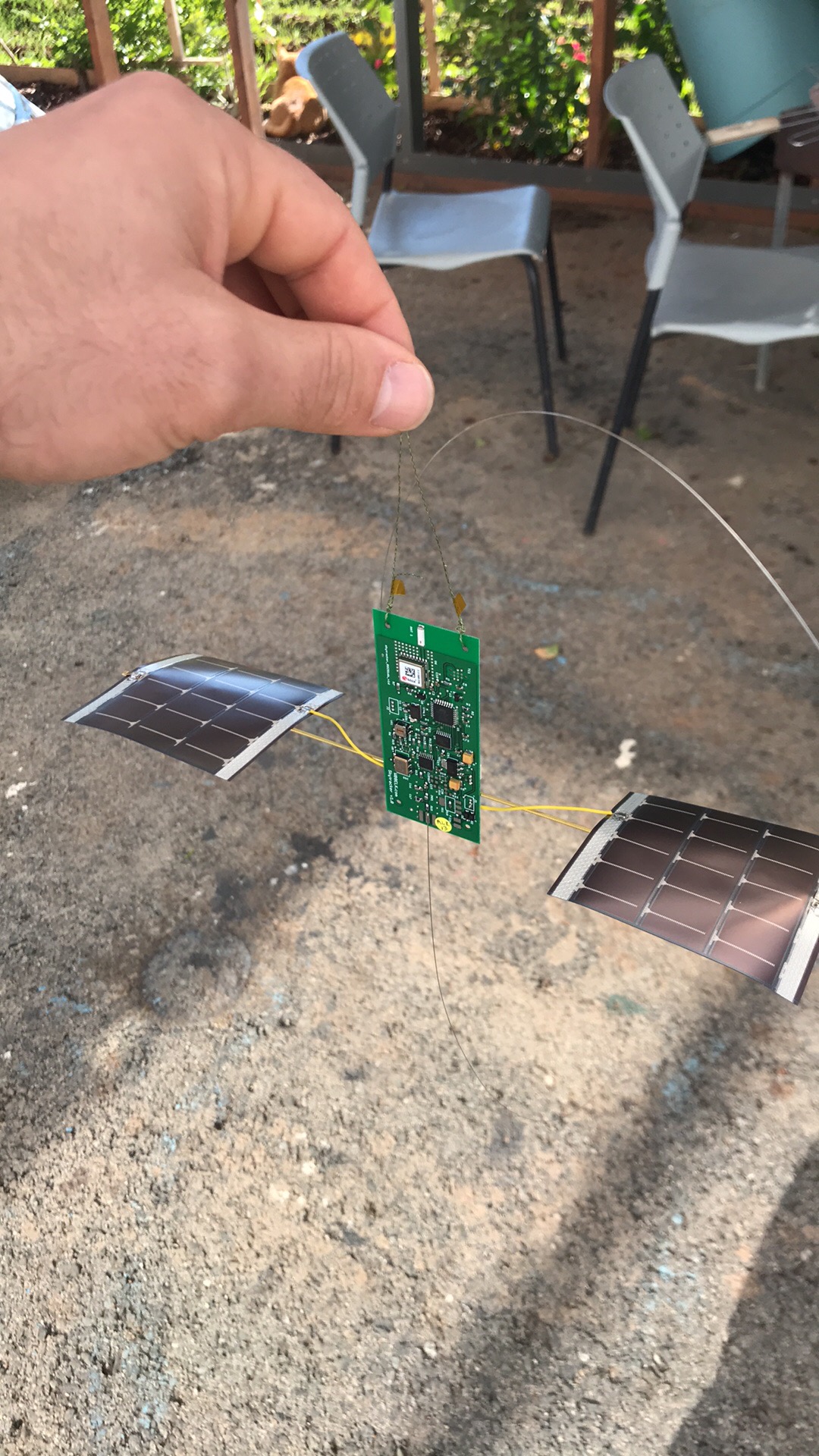
I am a new arrival, and will declare a vested interest, I sell PCBs for very simple LoRa based high altitude balloon trackers, its basically just to make sure my hobby, playing with LoRa and trackers, does not eat into my retirement savings, see;
Awesome, do you ship outside UK?
I think the best option is the lora satelite we have allready contacted laguna company waiting for their respond the second idea is to take the board this and basically switch the communication device from APRS ro lora simple but really very complicated but is possible :):):
Basically RAK can provide us with a custom vesrion of their board and also techical support - the Rak triobisba very good solution for our project if we modify it a bit :) instead of desing a pcb from scratch:):
Hello i have the pcb desing of the tracker please pm me to send you the desing thanks :)
Yes, I do ship outside of the UK.
I would love to see this aswel, perhaps share it to everyone in the thread, if it is not top secret that is
Can’t PM as a newbie.
On your screenshot, go to the output menu and tick “create hex file”, the you will have the bin file created during compilation
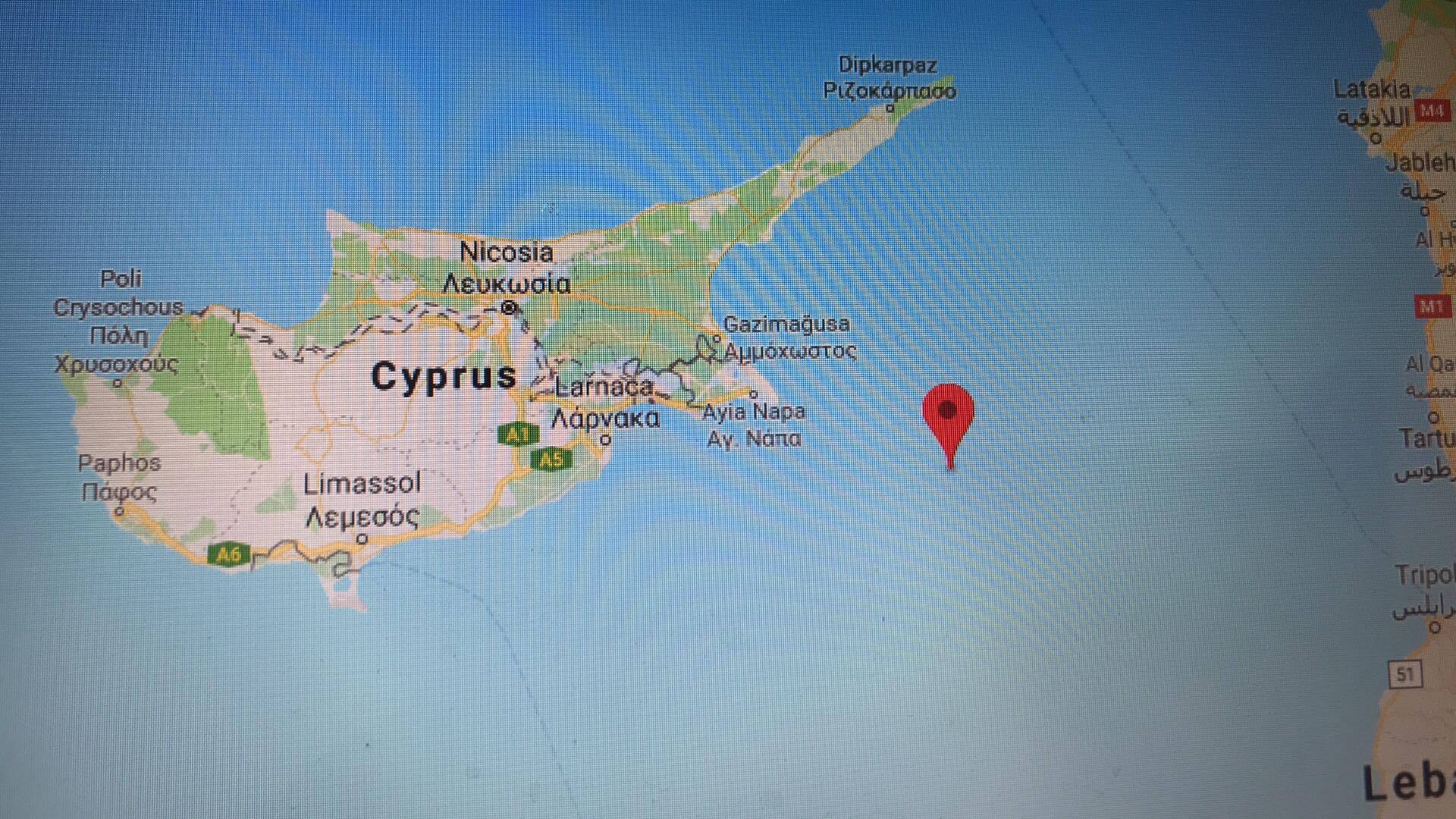
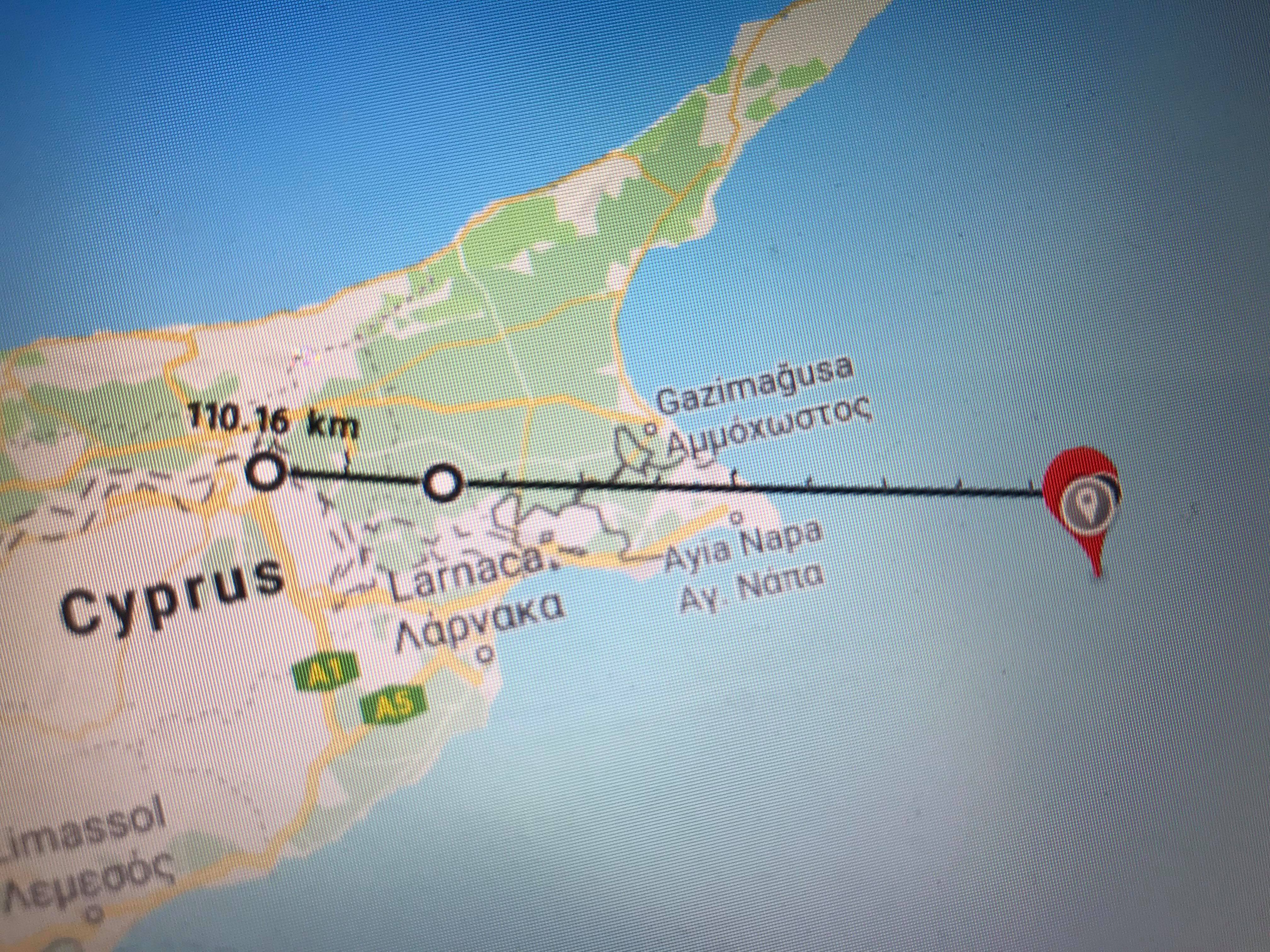
Awesome, nice work. 100 km is a good start 
Are they any ways to visualize the data ?
What kind of visualisation are you looking for?
Cayenne is one way to visualise the data.
You have the csv file, you can you this file to draw some chart on Microsoft Excel or similar software.
Another way would be to connect directly to TTN MQTT and use node-red to visualize the data.
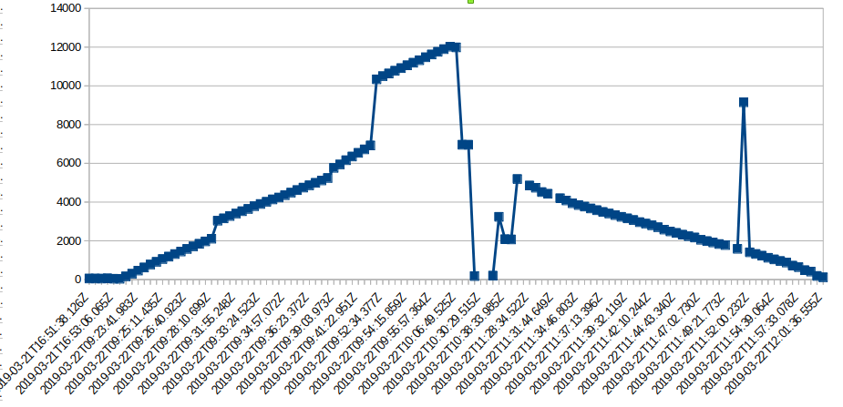
I have seen that you reached an altitude of 12000 meters, that’s great!
Here is a chart of altitude versus time based on your data.