I think the best option is the lora satelite we have allready contacted laguna company waiting for their respond the second idea is to take the board this and basically switch the communication device from APRS ro lora simple  but really very complicated but is possible :):):
Basically RAK can provide us with a custom vesrion of their board and also techical support - the Rak triobisba very good solution for our project if we modify it a bit :) instead of desing a pcb from scratch:):
Hello i have the pcb desing of the tracker please pm me to send you the desing thanks :)
Yes, I do ship outside of the UK.
I would love to see this aswel, perhaps share it to everyone in the thread, if it is not top secret that is
Can’t PM as a newbie.
1 Like
On your screenshot, go to the output menu and tick “create hex file”, the you will have the bin file created during compilation
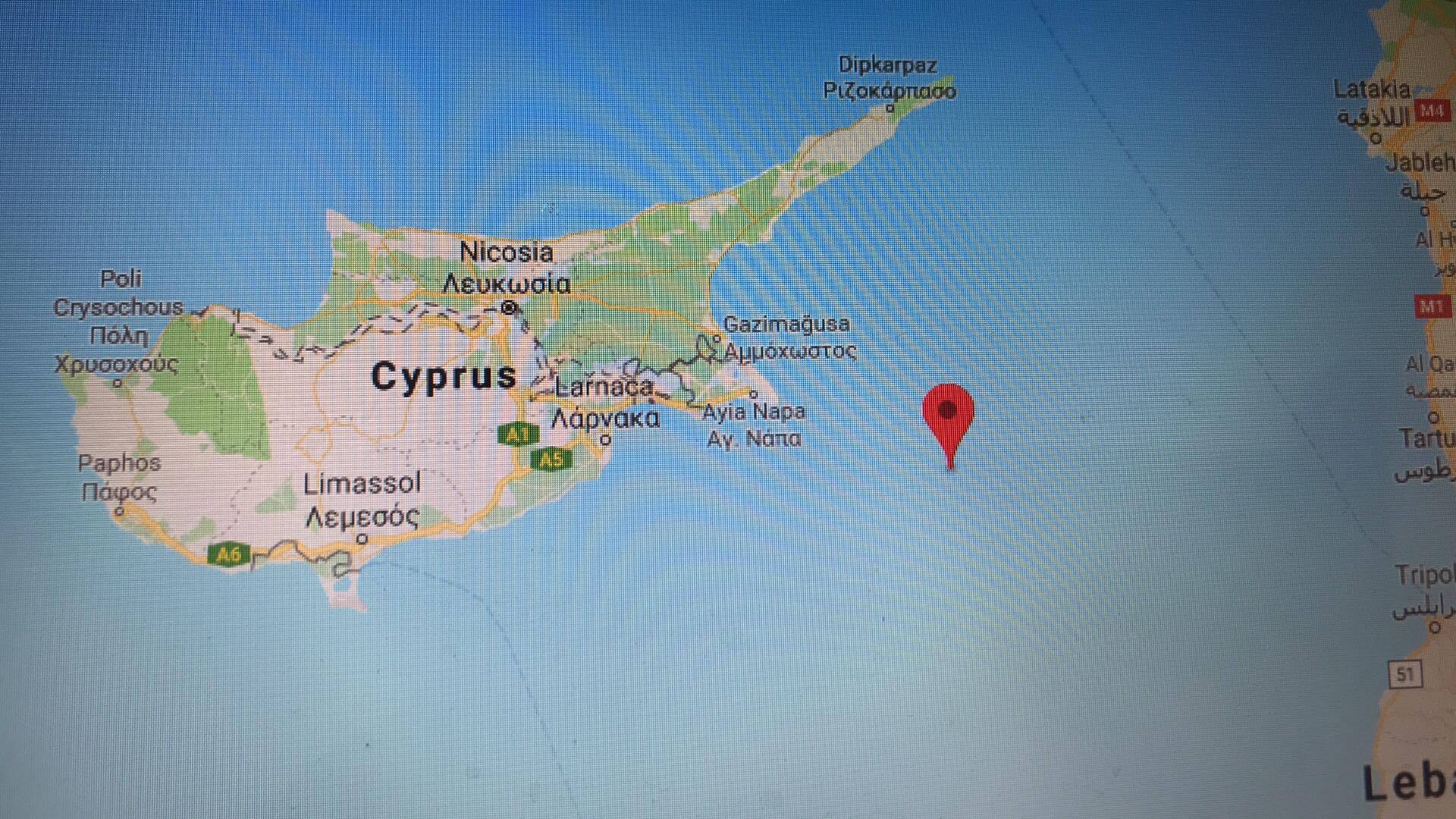
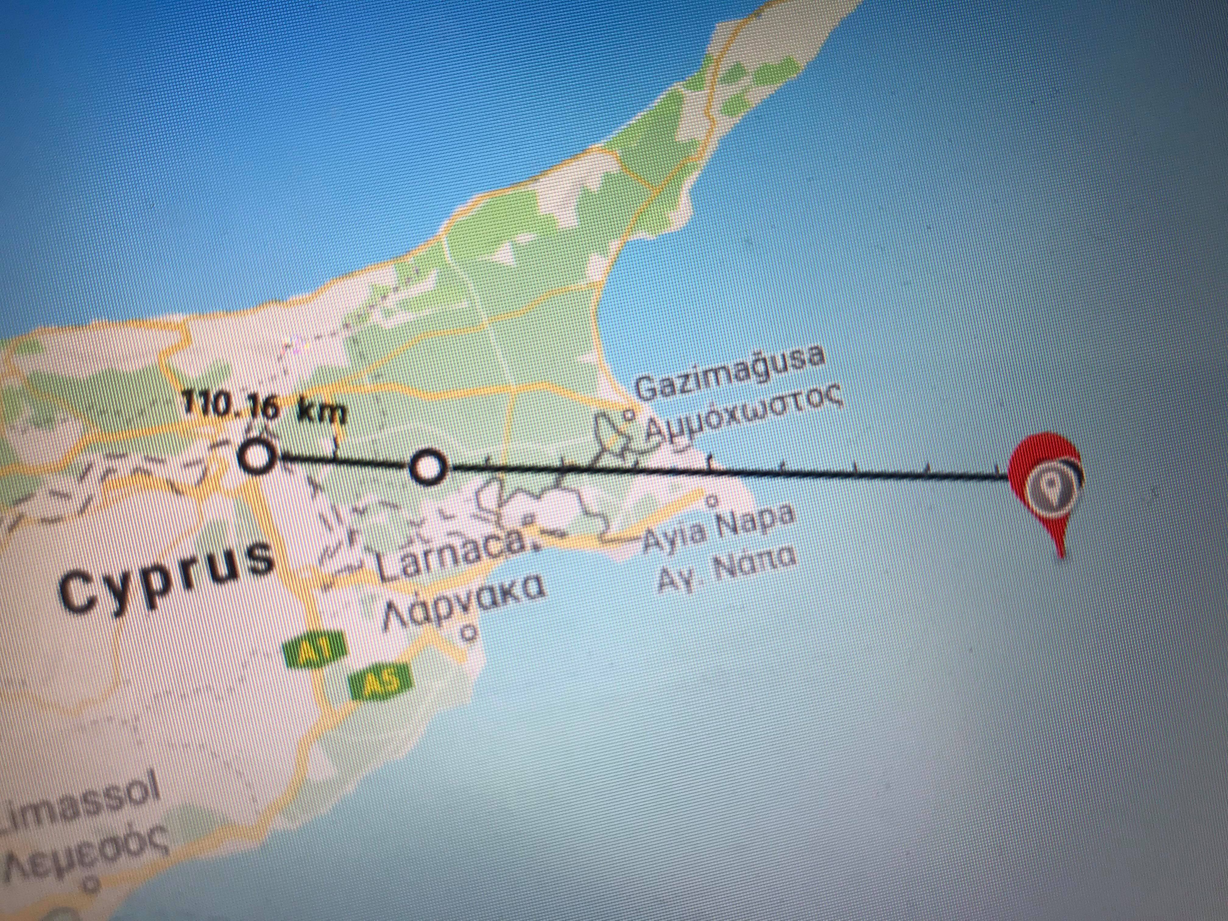
Awesome, nice work. 100 km is a good start 
Are they any ways to visualize the data ?
What kind of visualisation are you looking for?
Cayenne is one way to visualise the data.
You have the csv file, you can you this file to draw some chart on Microsoft Excel or similar software.
Another way would be to connect directly to TTN MQTT and use node-red to visualize the data.
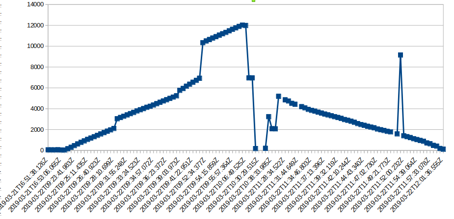
I have seen that you reached an altitude of 12000 meters, that’s great!
Here is a chart of altitude versus time based on your data.
Basically on the time of the expirament cayennes my device dident work and some time it gets stuck also ttn has a problem when you try to log in - a like this free services but we will show this expirament in front of 1.000 students what if in the day of the expirament cayene or ttn have problem again can you recommend a better morr reliable service ?
Perhaps, Grafana, Kibana?
By the way I saw no GPS data in the CSV, did I miss it?
The gps condinated are there for sure
I have found cayenne mydevices very reliable. I am surprised to see that it did not work.
You should have a look at node red. You can easily create a dashboard and retrieve the data from TTN by MQTT. Lot of information are available online.
Kibana or Grafana are also an option.
I found Grafana easier to use.
You can also have a look at application integration available in TTN.
Will try just found a really nice website
Just thought to pass gps and altitude from ttn and have a 3d visualization :):
Just received all parts from the sponsorship :) i will post some pictures soon :)
look forward your picture also in social
coming soon preparing for the first test :>:> can i ask if we can power up the RAK5205-WisTrio-LoRa with this ?
for battery
and for solar
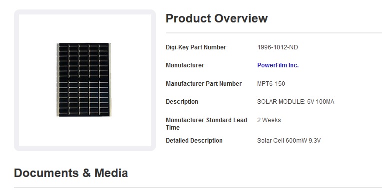
this
https://www.digikey.com/product-detail/en/MPT6-150/1996-1012-ND/9559462/?itemSeq=289834268